
Orography:
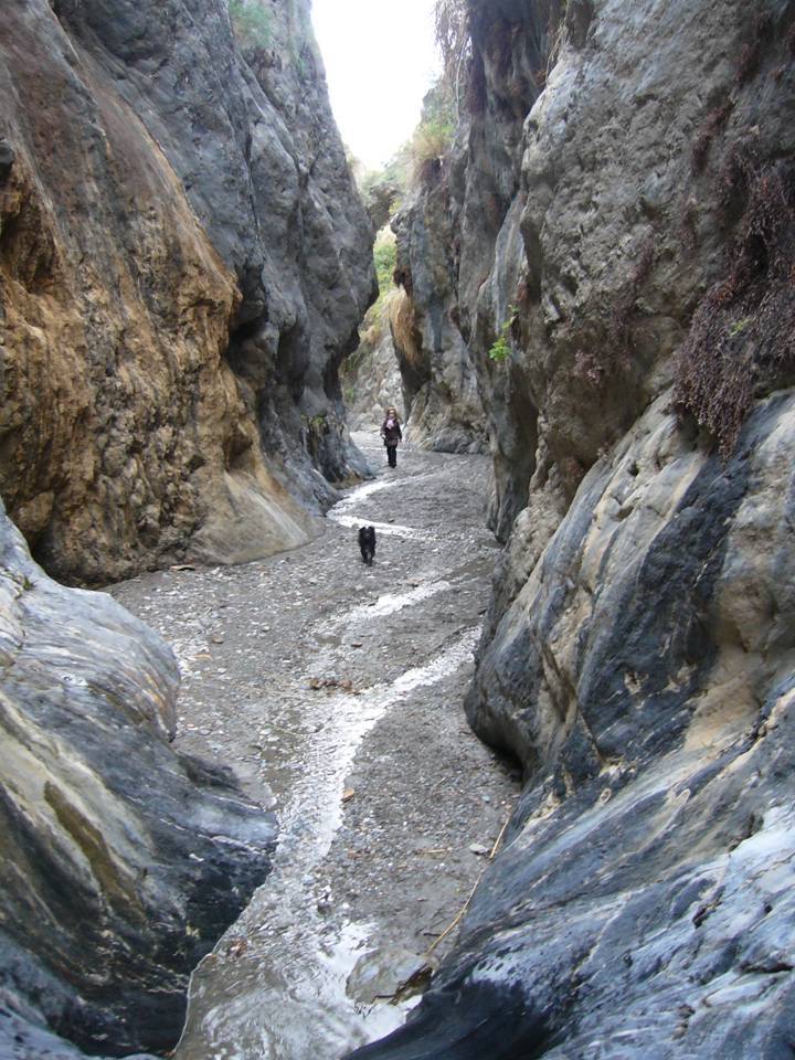
This path from Adra to the top of El Calar runs through the Sierra de La Contraviesa, which it is part of the Alpujarras Bajas. We can observe the typical materials of the Filabride snow cover that shape all these rocks composed mainly of schist of different consistencies. The river of Adra (Río Grande) functions as border to the east, separating the Sierra de La Contraviesa from the Sierra de Gádor. The southern part, by which we will move, is quite abrupt with several deep riverbeds and lots of ravines. The area of El Calar, as its name indicates, is composed of sedimentary materials such as limestone which are distributed over the metamorphic ones.
Anthropic reviews:
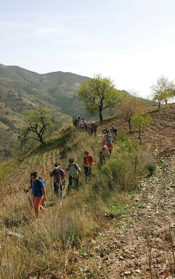
This route has tried to recover the old trail to Turón used by the inhabitants of both peoples to communicate and exchange goods by means of muleteers and malajiz (people who carried fish in wicker baskets). After passing the Cortijo de Bolaños, we undertake the climb up the Z. We will pass several ruins until reaching the Cortijo del Pintao, from whose patch we can descry the Cortijo de Periano, below The Calares. Soon we can see the great ruins of the Cortijo del Condado. Nearby, those of the Cortijo del Cercado, where the self-taught writer Enrique Sierra Valenzuela lived, can also be seen. During the rise to El Calar we can observe remains of an old limestone quarry and some ruins of several farmhouses. On the descent, we will pass close to the Cortijo del Agujerillo del viento and see some urban centers in the area of Romera and Los Enríquez. The long descent takes us back to pass near Bolaños and return to the trailhead in the riverbed of the same name.
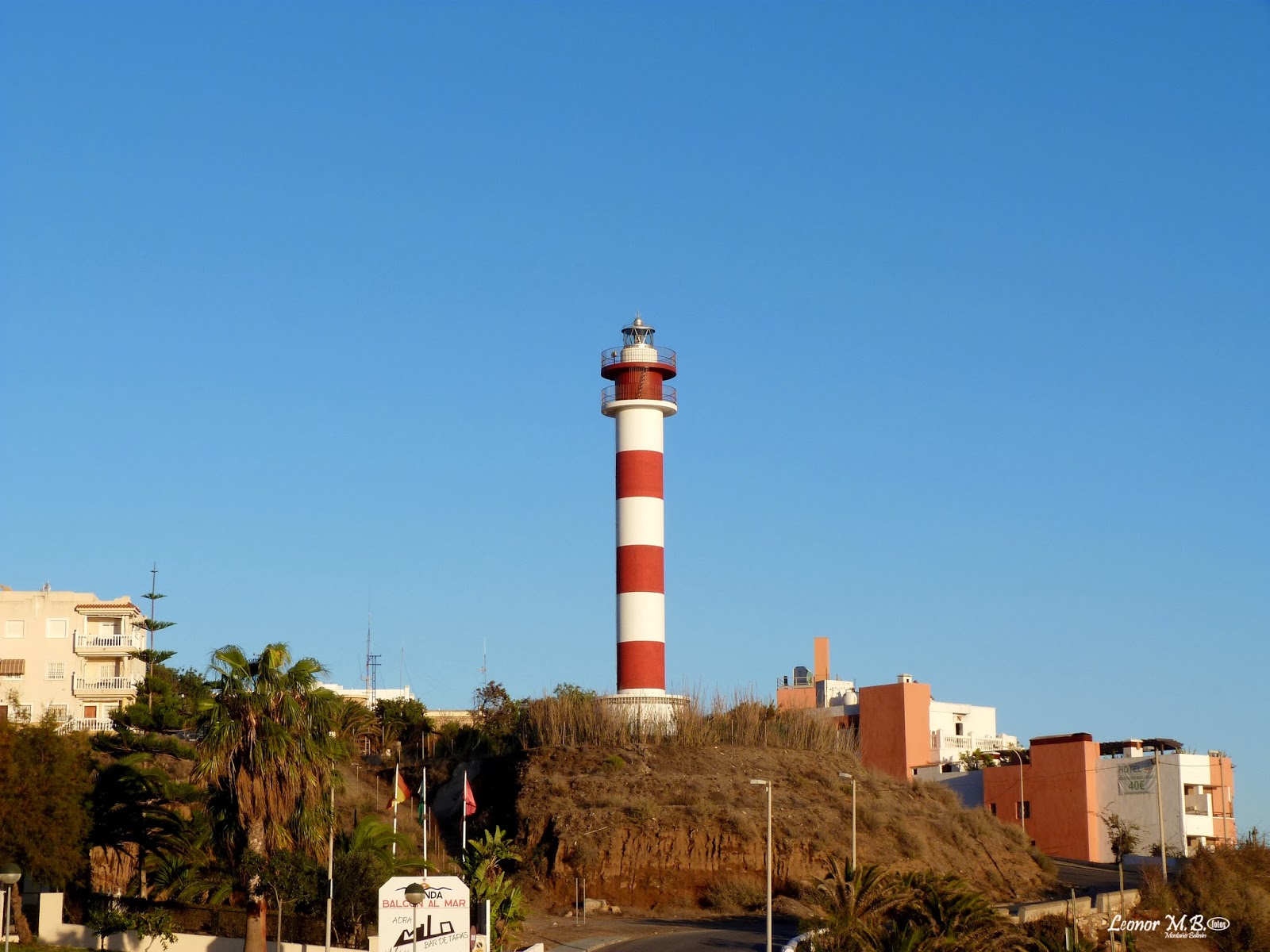
We cannot forget at any time the importance of the village with more history of the province of Almería. Abdera was founded by the Phoenicians in the eighth century B.C. having always been linked to the fisheries sector and maritime world.
Orography:
This path from Guainos to the Ermita San Isidro Labrador and the return to Guainos Bajos passes through the Sierra de La Contraviesa, which is part of the Alpujarras Bajas. We can observe the typical materials of the Filabride snow cover that shape all these rocks composed mainly of schist of different consistencies. The river of Adra (Río Grande) functions as border to the east, separating the Sierra de La Contraviesa from the Sierra de Gádor. The southern part, by which we will move, is quite abrupt with several deep riverbeds and lots of ravines. There are some areas where sedimentary materials such as limestone crop out, but most of the trail runs along the schistose materials of the so-called Alpujarride complex.
Anthropic reviews:
The route of the trail has tried to recover old paths, especially the cattle route called Colada de la Lanchaza, in two of its sections. The beginning of the trail is populated, since there are some constructions of mills with vestiges of the past of this city: the Casa de la Zorrera, Guainos Altos and the Molino de Soriano. Of a long tradition in the area is the called Estrechura, an alternative route of the path, although when carrying water it is impossible to pass. The trail will run through some ruins of a popular architecture of exceptional beauty and it will pass near three neighborhoods impregnated with the traditional Alpujarreño style that is still preserved in the city such as: Los Pérez, La Parra and El Barranco de Almerín. The descent overlooking the sea from the recovered Ermita de San Isidro is very beautiful. We can not forget at any time the importance of the village with more history of the province of Almería. Abdera was founded by the Phoenicians in the eighth century B.C. having always been linked to the fisheries sector and maritime world.
It is a both vertically and horizontally itinerary equipped with diverse equipment: nails, clamps, dams, banisters, suspension bridges and tyrolines, that allow to come safely to zones of difficult access for trekkers or not accustomed to the escalation.
It possesses a time of accomplishment brought near of 45 minutes and consists of a bridge tibetan, pretty bridge, suspension bridges, tyrolines, two sections of route ferrata, as well as pendulums, being one of few routes ferratas of the province that possesses this system. In addition it is put up signs and of easy access.

This path starts at San Nicolás beach; with a low level of difficulty, it is 913 meters long and runs through two beaches which have been awarded the Blue Flag and the 'Q for Tourist Quality', San Nicolás beach and Censo beach. The trail ends at Censo beach, in the spot known as “Camino Roto”, and lasts about 20 minutes.
The natural values of the path match the values of the characteristic habitat of the Mediterranean Sea's bank, with a soft coastal profile, made up of large beaches with fine sand and gravel. The trail's main purpose is to promote the sustainable development of the coastal areas by meeting the quality criteria which ensure the preservation and improvement of the environmental conditions, the safety and ease of use for visitors and an integrated and coherent management of the natural values that make up the coastline heritage.

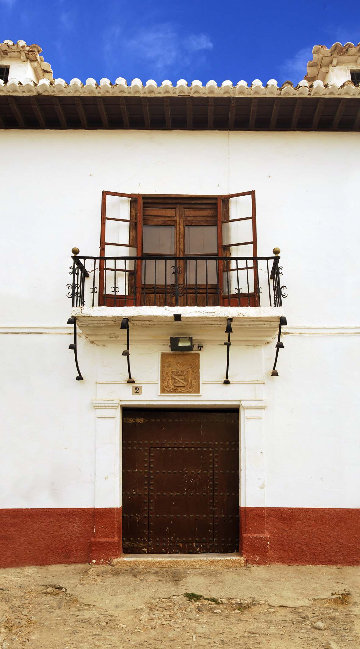
The economic wealth some families reached during the 18th century was reflected in the architectural style of their homes.
The facades presented three equal hollows. The central one was the door. Instead, the side hollows had grilles and formed two large windows. On the upper floor, the balconies had railings which were usually painted in warm and bright colors.
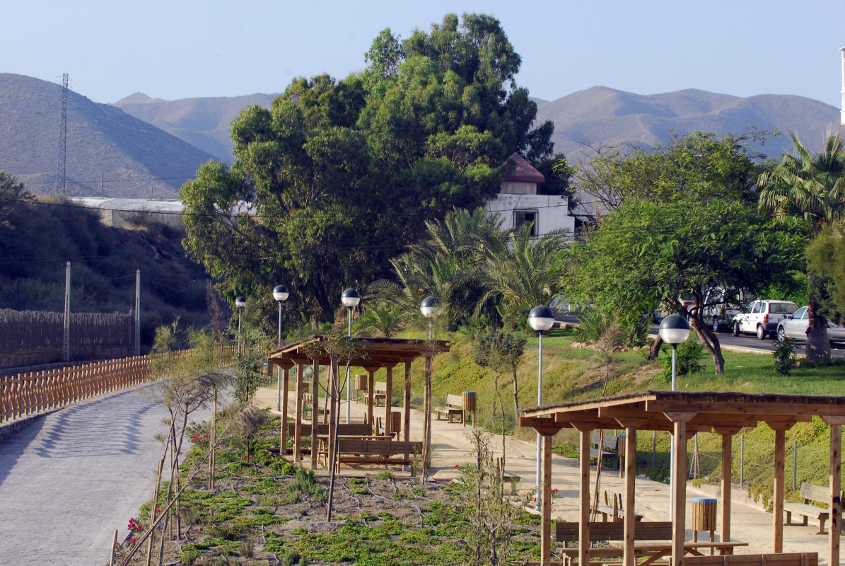
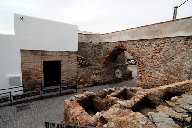
The urban trail of Adra, called 'SL A 58', runs through the old quarter along a five kilometers and two hours route approximately. The Plaza Puerta del Mar is the starting point of the track designed by the municipal consistory for walking around the town. From the town hall, the hiker heads towards the Iglesia de La Immaculada Concepción, passes through the Plaza Vieja and old manors up to reach the Ermita de San Sebastián. From this point, the visitor gets the Civil War air raid shelters and finally, visits the Fundición de San Andrés. The trail has a difficulty classified as medium or low so anybody can do it.
In addition, the Adra City Hall has installed eight information boards to guide the hiker along the path. Each contains details of the route, technical characteristics, a plane and data about the tour. The points where have been installed represent a good deal of the historical and cultural heritage of Adra.
On the other hand, the walker has the possibility of completing the information provided by the boards with a QR code. This is used to link your mobile to the website of the City Hall and receive details by means of audio guide.
Follow us


Adra Tourist Board.
All rights reserved.
Youth employment development 2014 |