
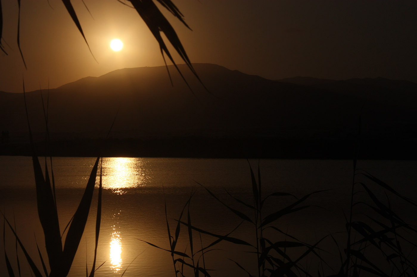
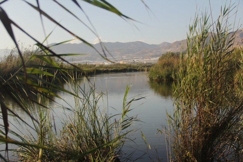
This coastal wetland, composed mainly of two lagoons, the Albufera Honda and the Albufera Nueva, surprises for its location in a semi-desert environment and surrounded by areas of intensive cultivation.
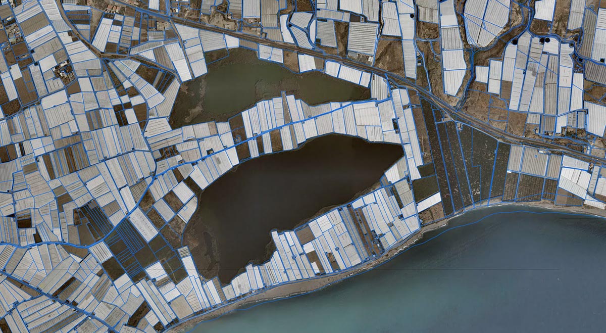
It is located between the mouth of the River Adra and the Dalías Plains, involving a constant source of food and life for the resident fauna in the area. Its brackish waters come from the seawater leaks and rainwater from the ravines of La Estanquera and Las Adelfas. The presence of permanent water, as well as the mild climate in winter has allowed this wetland to be considered the most important in the province of Almeria and a stopping point for migratory bird routes established between the European and African continents.
Visitors can observe abundant aquatic fauna from the observatories strategically placed in the lagoons, highlighting the presence of waterfowl such as the real anade or the shoveler, which arrive in autumn from northern Europe in search of food and a milder weather to spend the winter season. During the spring, the dense vegetation cover consisting of reeds and reedbeds, provides a suitable nesting place to species such as the coot or the ferruginous duck, which come from the distant steppes and semi-desert regions of Asia and occasionally reach areas of Andalusia or Levante (Eastern Spain).


Provincial Office of the Department of Environment of Andalusia (Junta de Andalucía)
Adress: Centro Residencial Oliveros, BL. Singular 2ª pl. 04071 Almería.
Telephone: 950 25 12 52; Fax: 950 23 08 98
E-mail: dp.explot.al@cma.junta-andalucia.es
The River Adra is the most important in the province of Almería for its great water flow. It’s born in Sierra Nevada and has three main tributaries; the tributary from Paterna flows near Alcolea, meets the tributary of Cherín (originating from Puerto de La Ragua) and, before reaching Darrical, joins the tributary coming from Ujíjar.
Once joined, the three tributaries pass through Darrical and go to Benínar swamp. After passing the swamp, the river flows through very narrow gorges called "Las Angosturas", and finally arrives at Las Fuentes De Marbella, a place where you can see a large water birth. During its descent, in Majaroba, the river joins the River Chico, a small tributary coming from Berja, thus constituting both a great river which supplies water for irrigating the crops of the area.
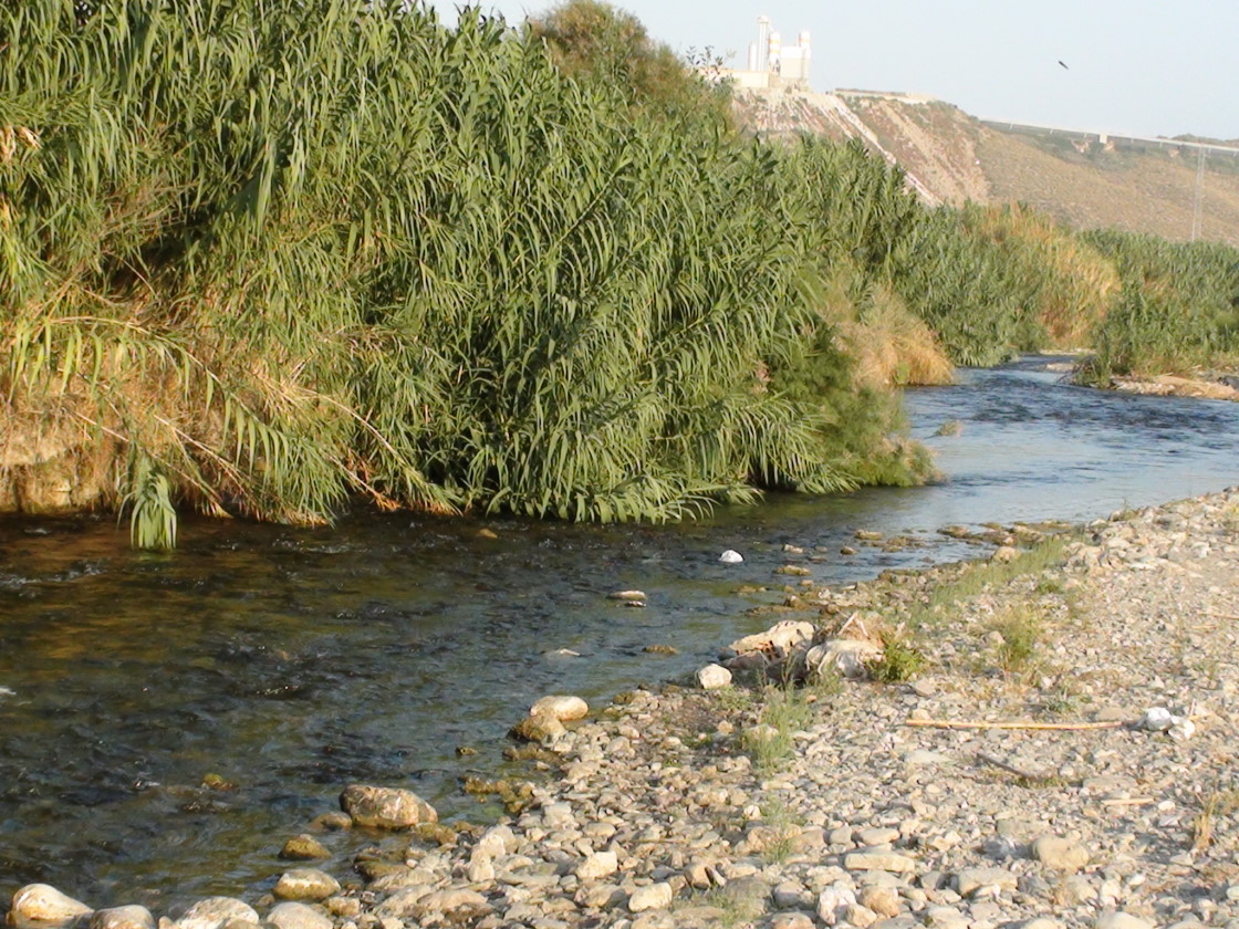

Following its natural course, the channeled water goes towards the natural spot of La Habana, an area where the river is walled on both sides to empty into the sea in a place called "La Boca del Río", within the municipality of Adra, town which gives its name to the river. Before constructing the Benínar swamp, this river had other direction and flowed into the town of Adra.
In the summer months, water was collected in "El Levantaero" to irrigate crops, which made possible "to cut" the river in order to take advantage of its flow and channel it through the "ditches", waterways that surround the farmland of La Alquería and Adra. This was done between the area of Los Checas and Los Columnas. There were two mills and two hydroelectric plants in the area of Las Fuentes de Marbella that worked with waterfall. Along the riverside there are a lot of reeds, tamarisks and acelguillas and we can see birds such as moorhens and sandpipers. In these waters we can also find the Fartet, an endangered native fish of the River Adra.
The pilgrimage of the ‘Virgen de las Angustias’ takes place in this river, on its way through the village La Alquería.
The ‘Estrechura’ of Guainos, as is popularly known the area, is something like the backbone of a riverbed which rises in Turón (Granada) and comes to die on the beach where Guainos Bajos stands.
To start the route through the ‘estrechuras’, it is necessary to dispense with any motorized vehicle, which means that the visitor must be equipped with comfortable and waterproof shoes to walk, inasmuch as water competes for the leading role with the spectacle of big mountains, which seem to join its stony walls on a hug on both sides of the natural and narrow corridor.
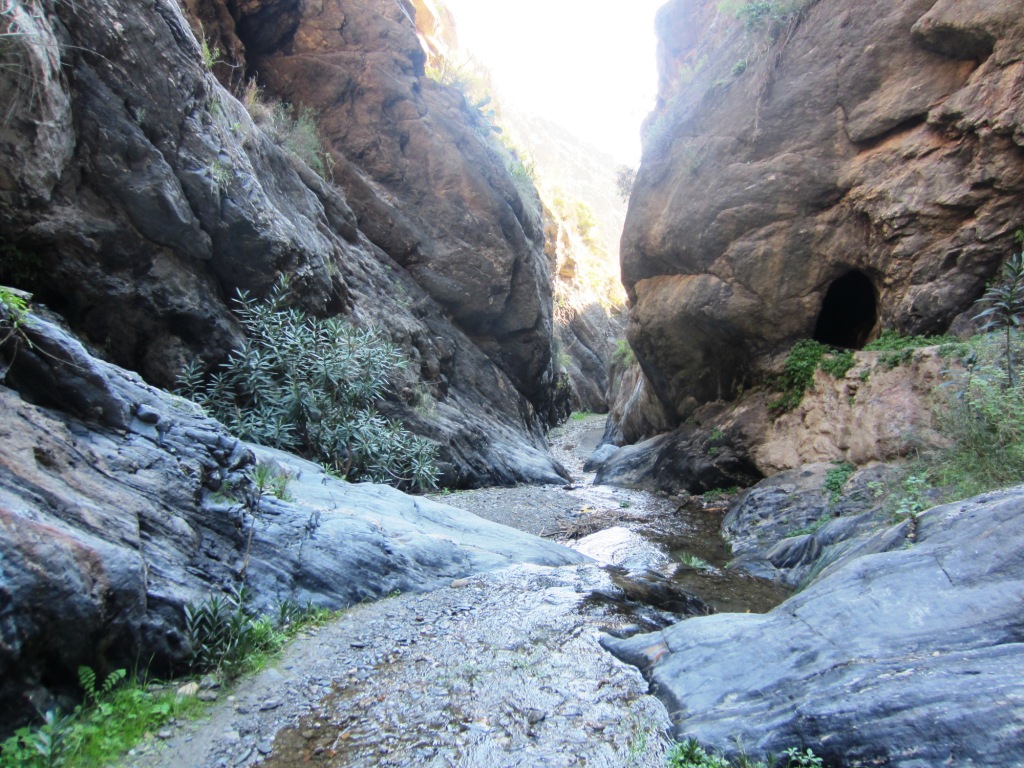
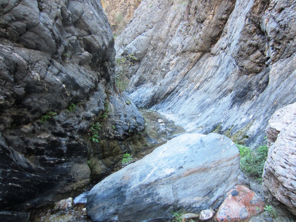
Once we start walking down the rocky path of the defile, we sense the presence of water, which is always faithful to the place. At first the road is dry, but as soon as we walk just a few meters, the floor starts to get wet. This is the announcement of a small flow of water whose centennial perseverance has managed to mold the rock and sculpt the gallery, what is fascinating for the walker.
The groves, ditches, orchards and ‘straits’ are predominant in the landscape, adding more attractive to a path that hosts traces of a past devoid of the current technological sophistication, as in the case of the old mill water, now disused.
The water purring and the birds chirping are the only sounds that dare to break in a natural silence that comes to disturb the urbanite’s soul.

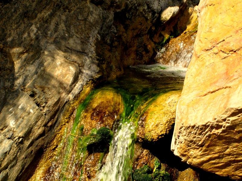
The riverbed of Guainos enjoys a unique flora dominated by oleanders and taray. The prickly pear monopolizes part of the landscape in the vicinity of Guainos Altos, a small village to be left on the right, up the riverbed, to reach the defile.
As for wildlife, some of the most characteristic species are the natterjack toad, the ocellated lizard and the eagle owl, without overlooking the ibex and the wild boar, well known by locals who have the courtesy to warn the adventurous visitor the chance to meet some specimens of these two animals.
For enjoying a nature walk it is worth to go to the 'Estrechuras' of Guainos. However, we must keep in mind that the route has some difficulties and it is not the most appropriate place to spend a Sunday relaxed with young children. The route, without being overly complicated, requires predisposed legs to walk for a few hours along a steep waterway which invites the hiker to keep alive the sense of prudence.
But leaving aside the small effort required to overcome a narrow path curdled with wet stones, the ride is rewarded at all times, especially if you can appreciate the existence of an almost unknown corner. A hidden corner in the foothills of Sierra Nevada and yet so close to the Mediterranean.
Follow us


Adra Tourist Board.
All rights reserved.
Youth employment development 2014 |